


2020-09-16
|The NETWORK
|Source: komonews.com
By Scott Sistek
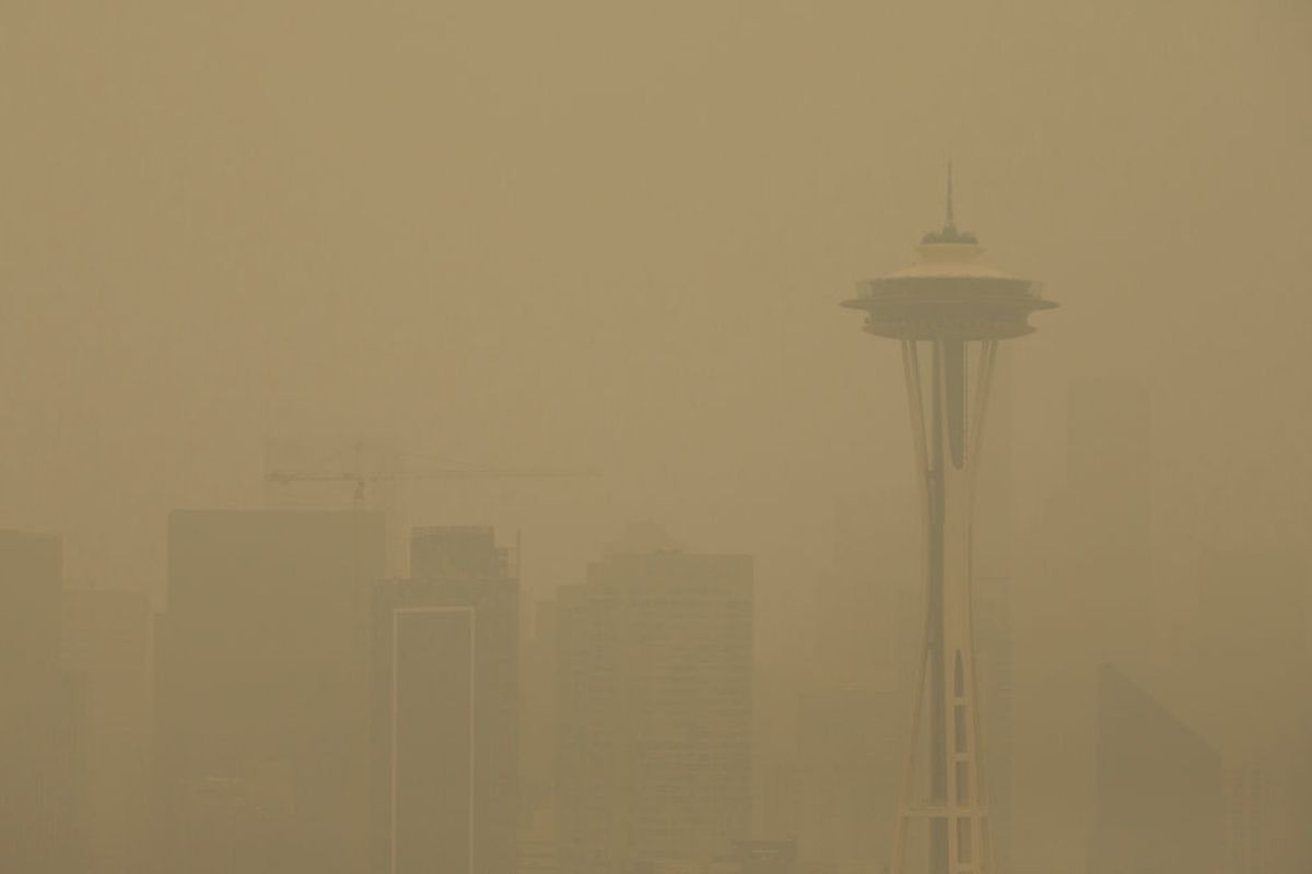
There were a few signs of weather normalcy around the Puget Sound region Tuesday -- even a few passing peeks of mostly unfiltered sun in the North Sound and the pitter-patter of raindrops -- but it's going to take another few days to really get some semblance of normal around the region as a fresh wave of smoke is inbound.
Air quality had some slight improvement Tuesday night with readings in the upper 100s along the coast and North Sound -- good for only "unhealthy" air quality, but the readings were solidly in the 200s around the greater Seattle/Puget Sound region for more "very unhealthy" air quality with borderline "hazardous" conditions in some spots.
Seattle's streak of consecutive hours with at least 2 miles or worse visibility reached 116 hours early Wednesday morning, though at 5 a.m. it had finally reached 2 miles for the first time since early Saturday morning.
Unfortunately, this slight improving trend looks to be short-lived Wednesday as the winds conspire to bring in a re-enforcing shot of smoke from the Oregon wildfires again during the day.
A swirling low pressure center that looks to eventually be the trigger for our smoky salvation is penalizing us first by bringing up a fresh batch (ooooh, 'fresh' might be the wrong word choice here...) of southerly winds, carrying up more smoke from the south, especially aloft.
Thus expect a smokier, darker day perhaps closer to what we went through on Saturday if the projections are correct.
Thursday could be a rather wild weather day with several variables in play that will both help and hurt the smoke simultaneously.
Let's start with the good news -- forecast charts are still pretty adamant that that big low will begin to trek toward the Oregon Coast on September 17, eventually heading into Oregon on Friday. Unlike Monday/Tuesday's low that didn't bring much of anything south of Mount Vernon, the models think Thursday's system still has potential for a decent wetting rain.
Indications are for as much as half inch of rain across Southwestern Washington and the Olympic Peninsula with about a quarter inch of rain or so in the I-5 corridor.
However, winds will remain south for a while perhaps still carrying some smoke up this way despite the rain (though the rain will knock out some of the smoke particles). But perhaps even worse, the atmosphere -- at least in a non-smoky world -- looks very unstable on Thursday with what would bring a decent chance of scattered thunderstorms especially later in the day into Thursday night.
The smoke complicates the thunderstorm forecast as it would inhibit convection but if the winds and rain do manage to mix things up enough to get warmer air at the surface and much cooler at aloft we could see some thunderstorms develop.
Of course the last thing anyone wants to see (aside from photographers) is any lightning around here to spark any new wildfires. The silver lining is at least rain would be coming with any thunderstorms - they aren't "dry thunderstorms" like we saw earlier this summer.
The thunderstorm chances shift into Eastern Washington on Friday and... that's not good either.
But around here once that storm passes the wind should FINALLY veer to more of the southwest and west Friday into the weekend. Unlike last weekend, this time we haven't blown a bunch of smoke out over the ocean so the marine breezes are back to their clean, fresh-air self.
We are really hoping for some improving widespread improving air quality Friday into the weekend. And the National Weather Service had some good news for the extended forecast: "Upper level winds will generally be from west to east during the first part of next week, so additional smoke is not expected Sun through mid-week."
Until then we have a couple more days of playing defense with the smoke. Hang in there!
Worst smoke ever?
Many have been asking if this is the worst smoke/air quality event in the region's history, which would be saying something considering the terrible smoke season in the summer of 2018.
It turns out it depends on how you want to measure it. Dr. Beth Friedman with the Washington Department of Ecology found that if you want to measure by time spent in really bad air quality - both the smoke events of 2017 and 2018 lasted longer than our current smoky streak (remember, those happened earlier in the summer -- 2017 was late July/early August while 2018 was mid-late August) so there was more time in the fire season.
BUT! The smoke this time around is considerably worse as far as keeping residents in the more dangerous air quality readings. The 2020 event so far has far outlasted both the 2017 and 2018 events if you measure the number of hours spent in "very unhealthy" and "hazardous" categories.
And while we are looking for a reprieve later this week and over the weekend, the fires in Oregon will likely keep burning for a while longer meaning it'll only take another weather pattern shift to have the smoke make a return appearance.
Read the original story here.